After building a satellite antenna, I was able to receive and decode the weather maps sent by three US-based legacy satellites operated by the National Oceanic and Atmospheric Administration (NOAA).
Hardware
As mentioned, I used my own antenna. To get the signal into my PC, I used the excellent and low-cost RTL-SDR stick V3 by RTL-SDR.com. My base station consisted of the following parts:
- Antenna, see this post.
- RTL-SDR Stick V3, https://www.rtl-sdr.com/buy-rtl-sdr-dvb-t-dongles/ (~20€)
- RTL-SDR Wideband LNA, https://www.rtl-sdr.com/buy-rtl-sdr-dvb-t-dongles/ (~15€)
- SMA-Coax coupling, https://www.amazon.de/gp/product/B006UYO2NG (~2€)
- SMA-SMA coupling, https://www.amazon.de/gp/product/B004NEHTIU (~3€)
Software
To decode and process the incoming signal, I used a number of programs on my Windows PC:
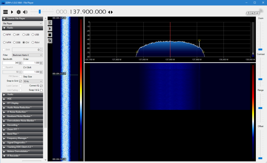
- SDR Base Software: SDR# https://airspy.com/download/
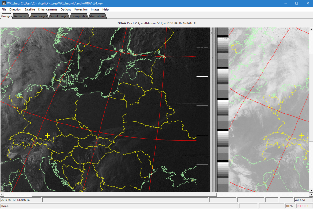
- Decoder: WxToImg https://wxtoimgrestored.xyz/
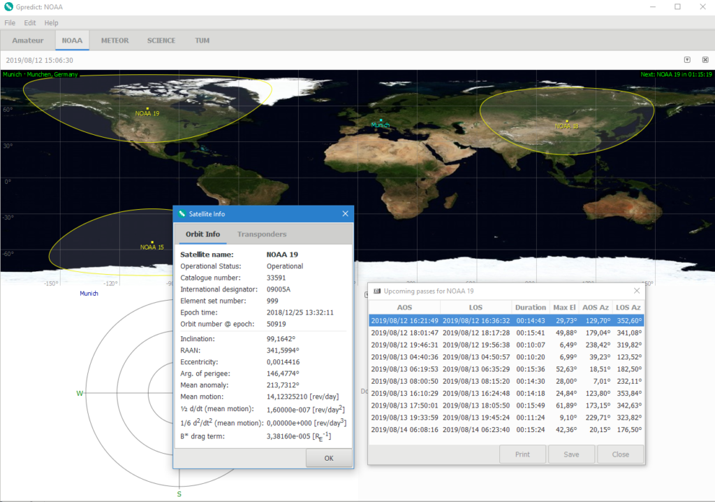
- For tracking either:
- Orbitron http://www.stoff.pl/
- DDE Tracker for SDR# https://www.satsignal.eu/software/DDETracker.html
- Alternatively:
- GPredict http://gpredict.oz9aec.net/
- GPredictConnector for SDR# https://github.com/alexwahl/SDRSharp.GpredictConnector
Setting the software up is a bit finicky, when in doubt refer to the excellent rtl-sdr blog at https://www.rtl-sdr.com/rtl-sdr-tutorial-receiving-noaa-weather-satellite-images/, or to http://init.sh/?p=275.
Operation
The tracking software should start recording and decoding of the incoming signal automatically, based on the calculated position of the satellite.
After being triggered by the tracking software, SDR# then decodes the incoming signal.
Finally, the WXToImg software takes the demodulated audio stream coming from SDR# and converts it to images.
Video Demonstration
I recorded the whole process into a video.
Results
Here are some pictures I received:
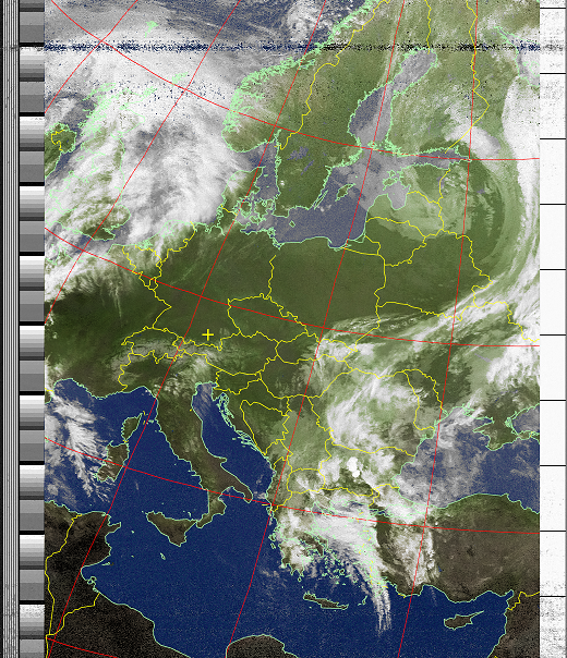
Color image. 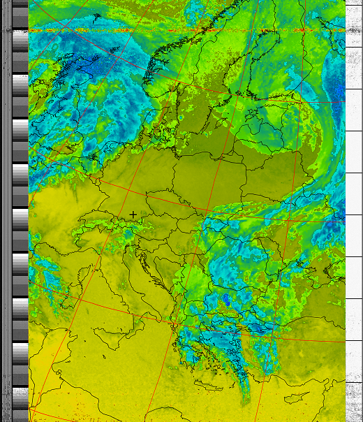
Thermal image.